Backed by
MicrosoftNVIDIA InceptionPathlight VenturesUnusual VenturesDisaster LabASUMicrosoftNVIDIA InceptionPathlight VenturesUnusual VenturesDisaster LabASU
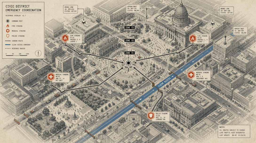
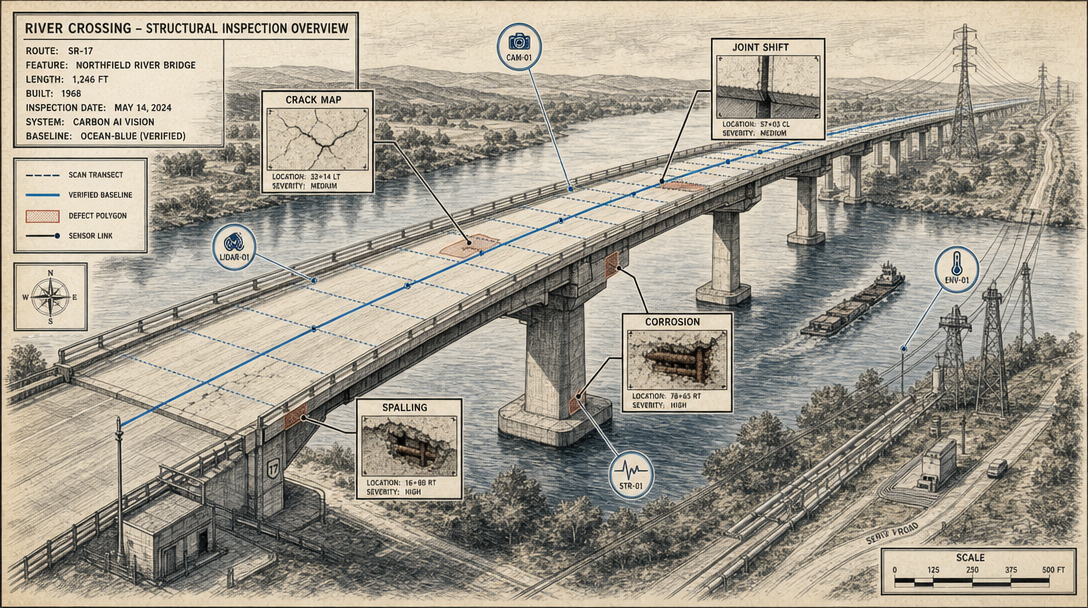
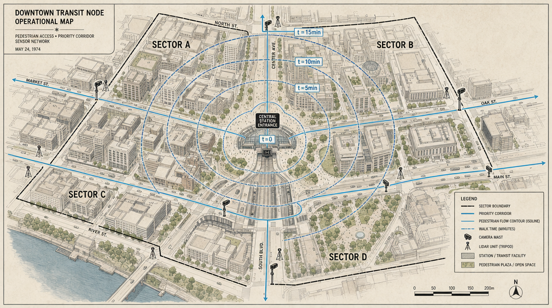
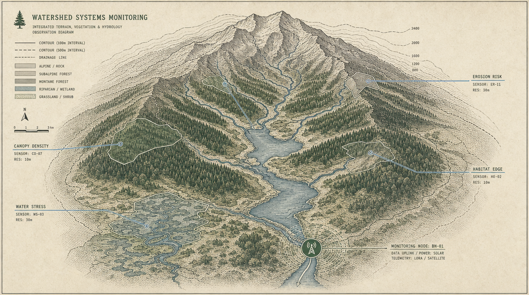
Reconstruct, understand, and simulate the physical world at scale.
ReconstructUnderstandSimulateDeploy
The intelligence layer for
everything physical.
Metric 3D from any sensor.
Phone cameras to LiDAR to satellite.
Queryable scene graphs with
centimeter-level spatial accuracy.
Percept maps your environment,
connecting to real terrain and physics.
Scroll
percept